
PUBLISHED: IN PRESS
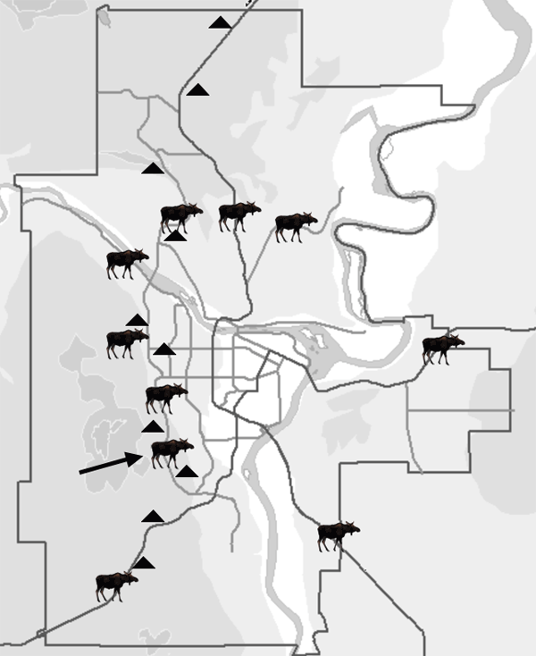
Figure 2. Road map of Prince George indicating collision hotspots (indicated with a moose icon), plotted using data taken from the Conservation Officer Service and City Records between January 1, 2001, and April 26, 2004. Triangles represent existing moose warning signs. Note: The arrow indicates the one hotspot that remained within the city following implementation.