PUBLISHED: MAY 2008

Impacts of Urban Runoff on Native Woody Vegetation at Clark Reservation State Park, Jamesville, NY

Figure 1

Recent Google Earth view of Dry Lake and Glacier Lake, their watershed areas (dotted light blue), the nearly completed Doubletree residential development (solid red border), and the proposed development Hummel Estates (dotted red border). The detention basin for Doubletree and the intermittent outflow stream that connects to Dry Lake are shown in medium blue.

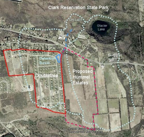
Figure 1: Recent Google Earth view of Dry Lake and Glacier Lake, their watershed areas (dotted light blue), the nearly completed Doubletree residential development (solid red border), and the proposed development Hummel Estates (dotted red border). The detention basin for Doubletree and the intermittent outflow stream that connects to Dry Lake are shown in medium blue.